ReSAKSS Country eAtlas Tool Expands the Reach of Information – to the Local Level
Five years ago, if you wanted geospatial information about food systems in most countries in Africa, you went for a walk. “Only a handful of agencies tracked key nutrition and agricultural indicators with any geographic specificity” says ReSAKSS Africawide Coordinator, John Ulimwengu. The data was scattered across regional and international institutions and not usually user-friendly. “Only a trained geographer could put the data to use – if she or he could find the data in the first place.”
Imagine a country like Nigeria, with a population of 200 million across nearly 1 million square kilometers. Are national averages a trusty indicator for designing policies and programs across the entire country? Or the Democratic Republic of Congo, with roughly 86 million people, spread across an area three times the size of Nigeria. Countries are too big to rely on clunky national averages, so a lot of guesswork was involved for policymakers, advocates or civil society agencies that wanted to target the local systems dynamics of agricultural productivity and markets, food security and health within a specific region. Guessing, or going for a walk.
Now anyone with internet access can access and view this information on the interactive mapping ReSAKSS Country eAtlas tool. The ReSAKSS Country eAtlas has been a game-changer. Since its launch in 2017 it has expanded to nearly 25 African countries, becoming Africa’s most important agricultural development mapping tool and the primary hub for geospatial information on agricultural development, crop production and health.Gathering data from regional sources such as national Ministries of Agriculture and Bureau of Statistics, as well as international sources such as Demographic and Health Surveys (of the U.S. Agency for International Development) and World Food Programme, the eAtlas makes an impressive array of data available to users. More surveys now include geographic coordinates, but there had not been a platform for utilizing the geographic component before the eAtlas. Regular outreach and trainings by ReSAKSS eAtlas designers keep everyone from country-level technicians to civil society workers up-to-speed on how to make the most of the available data and the eAtlas mapping tool.
Integration into local institutions and regular trainings are a core component of eAtlas’ impact. ReSAKSS has trained roughly 1,000 local eAtlas technicians and users since its launch. Local capacity strengthening workshops imbed the eAtlas management into hands of local institutions. Once the ReSAKSS team has launched a country eAtlas, technicians within that Member State become responsible for managing and updating the data, working with the ReSAKSS team to ensure the highest level of accuracy and relevance. Coordinating different data sources is an important element of eAtlas. “You cannot look at one narrow component of the food system and hope to make positive change for human health and local economies,” says Ulimwengu, “Most of the time when we look at agricultural investment we look merely at agricultural GDP growth, ignoring the other elements of soil health, human health, markets, human capital, gender, etc. that converge to make a food system.” The eAtlas invites users to combine the many systemic components of food and agriculture systems by considering the data and investments in everything from crop yields to health services, from consumer trends to education, from access to agricultural inputs to local social capital.
The attractive and intuitive eAtlas interface make the data useful not only to trained geographic specialists, but to anyone interested creating maps of demographic, agricultural, economic and health data. The eAtlas puts geospatial data into the hands of the people (as well as researchers) – and trains them in how to use the tool, how to tell a story or advocate for a policy based the geospatial information in maps. No other organization has worked so diligently within the African continent to empower everyone—from farmer and health organizations to high-level government technicians—with the tools and agency to use geospatial data,” says eAtlas developer Mohamed Ahid. The tool is invaluable for designing policies and programs suited to regionally-specific needs and opportunities.
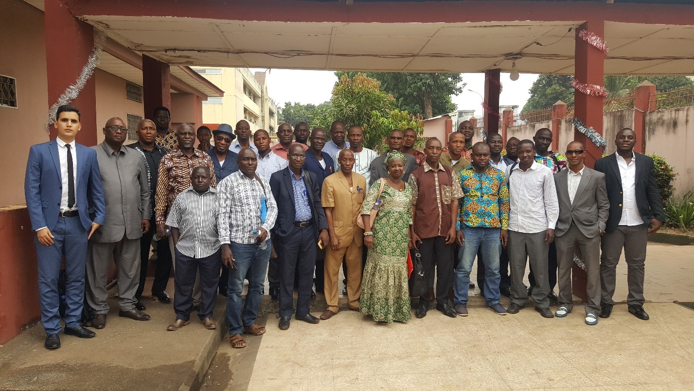
Participants at the eAtlas training workshop in Guinea. January 2019.
John Ulimwengu emphasizes the importance of disaggregated localized data. “If, in a food or agriculture intervention, you target a country’s national average, you might be completely off, missing a lot of people and wasting a lot of resources. Look at malnutrition—the difference across regions! Using a national average is as reckless as a novice just throwing a bowling ball down the lane, hoping to hit something. Given the need to efficiently allocate the limited resources we have, we’re interested in a targeted aim.” Geographic specificity is essential to administration since many decisions occur at the local or regional level. For example, in Nigeria, fertilizer subsidies are decided at the State level, not national level – but if States have no local disaggregated data, it’s impossible to advocate, attract investment, or implement policies appropriately.
Throughout 2019 ReSAKSS has continued supporting countries to utilize and manage their eAtlases by updating eAtlas platforms and training country teams. In January, ReSAKSS trained 40 participants from various Guinean government institutions and ministries. This core group will now collect, analyze and validate data and encode them in the eAtlas. Small working groups of 5 technical experts from the Ministry of Agriculture, Ministry of Fisheries, and National Bureau of Statistic will take charge of updating Guinea’s data to ensure effective management of the eAtlas going forward. In March, in Rwanda, Ghana and Kenya, ReSAKSS trained 30-35 Civil Society representatives from each country as part of the Voice for Change Partnership (V4CP) with SNV. Training sessions emphasized employing the eAtlas to extract data in support of policies for food security and nutrition. Participants were trained in how to use and apply the online tool, and ReSAKSS solicited input for ideas on new data to help illuminate the other obstacles to improving each country’s nutritional outcomes.
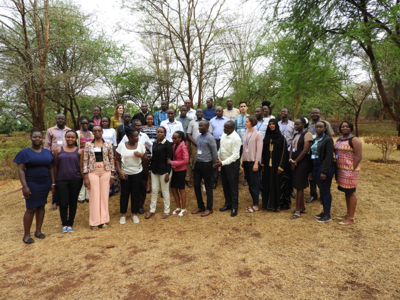
Participants at the SNV Training Workshop in Kenya in March 2019
ReSAKSS aims to extend the eAtlas to all African Union Member states, but thoughtfully partners with countries only when invited. Success of the eAtlas depends on the invested interest of the host country that assumes responsibility for maintain and choosing data for the eAtlas. Some country eAtlas exists on the platform but still need to be delivered to the country for their full management—that process is more relational and political than technical. “The eAtlas is not just a technical platform” stresses Ahid, “it is a relationship between ReSAKSS, country governments and the many technicians and users on the ground – that is what makes eAtlas a powerful tool and what will sustain it usefulness, viability and impact into the future.”
Give the eAtlas a try yourself! You’ll be sure to learn something (and you’ll probably have a lot of fun).
If you’d like an introduction, this 2-minute video provides a user-guide overview.
By Julie Kurtz.