Related Resources
PUBLICATION
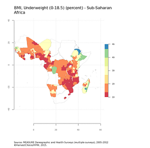
Health and Nutrition
Health and Nutrition
PUBLICATION
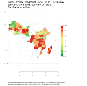
Poverty
Poverty
PUBLICATION
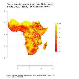
Markets
Markets
PUBLICATION
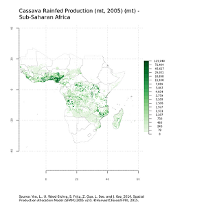
Production of crops
Production of crops
PUBLICATION
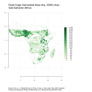
Area harvested of crops
Area harvested of crops
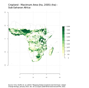
Land Cover and Use
SERIES NAME
HarvestChoice Data
YEAR
Various
ABSTRACT
Variables related to land cover, waterbodies, irrigated areas, watersheds and protected areas.
GIS data for this theme, accompanying data tables, metadata and user license can be accessed below.
Download GIS data Download Data Tables and Metadata
AUTHOR
Stefan Siebert, Verena Henrich, Karen Frenken and Jacob Burke. Fritz, Steffen et. al (Rheinische Friedrich-Wilhelms-University, Bonn, Germany). The United Nations Environment Programme's World Conservation Monitoring Centre (UNEP-WCMC). Carroll, M.L., J.R. Townshend, C.M. DiMiceli, P. Noojipady, and R.A. Sohlberg. Center for International Earth Science Information Network (CIESIN), Columbia University; International Food Policy Research Institute (IFPRI); The World Bank; and Centro Internacional de Agricultura Tropical (CIAT).
PUBLISHER
International Food Policy Research Institute (IFPRI), Washington DC, USA
Learn more about HarvestChoice here
Related Resources
PUBLICATION
Health and Nutrition
Health and Nutrition
PUBLICATION
Poverty
Poverty
PUBLICATION
Markets
Markets
PUBLICATION
Production of crops
Production of crops
PUBLICATION
Area harvested of crops
Area harvested of crops