Related Resources
PUBLICATION
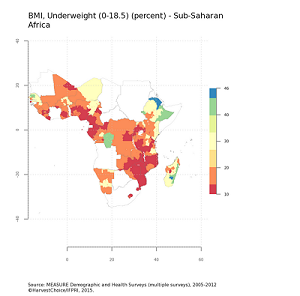
Health and Nutrition
Health and Nutrition
PUBLICATION
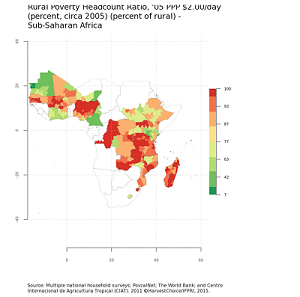
Poverty
Poverty
PUBLICATION
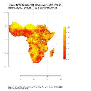
Markets
Markets
PUBLICATION
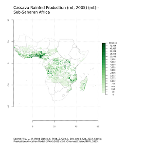
Production of crops
Production of crops
PUBLICATION
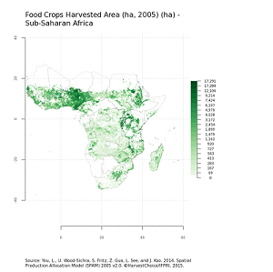
Area harvested of crops
Area harvested of crops
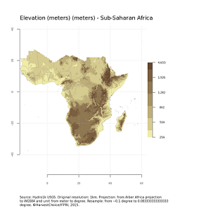
Elevation
AUTHOR
Zhe Guo, International Food Policy Research Institute (IFPRI) and United States Geographical Survey (USGS).
SERIES NAME
HarvestChoice Data
ABSTRACT
Elevation of pixel above/below sea level and slope. From Hydro1k USGS. Original resolution: 1km. Projection: from Alber Africa projection to WGS84 and unit from meter to degree. Resample: from ~0.1 degree to 0.083333333333333 degree.
GIS data for this theme, accompanying data tables, metadata and user license can be accessed below.
Download GIS data Download Data Tables and MetadataPUBLISHER
International Food Policy Research Institute (IFPRI), Washington DC, USA
Learn more about HarvestChoice here
Related Resources
PUBLICATION
Health and Nutrition
Health and Nutrition
PUBLICATION
Poverty
Poverty
PUBLICATION
Markets
Markets
PUBLICATION
Production of crops
Production of crops
PUBLICATION
Area harvested of crops
Area harvested of crops